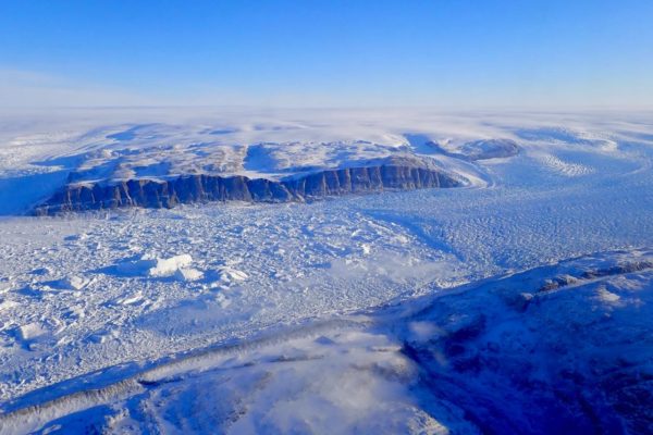
AUSTIN, Texas — We know ice is melting on the Earth’s poles. But how fast? New data gathered using a green laser in space is helping scientists track the melting ice and giving us a new elevated view of climate change.
NASA’s Ice, Cloud and land Elevation Satellite-2 (ICESat-2), which launched in September 2018, uses this laser to measure the elevation of the surface of the Earth. The satellite, developed with help from scientists at the University of Texas at Austin’s Applied Research Laboratories, can track changes in the elevation of the planet’s polar ice sheets to within a fraction of an inch.
“This data is really helping us understand what is happening on our planet right now,” said Lori Magruder, a senior research scientist at UT Austin and the ICESat-2 science team lead. “The elevation changes that we’re able to measure over the ice sheets can help infer global sea level rise. And those models have been used to refine our ability to predict climate change.”
The ICESat-2 mission contributes to a record of polar height data gathered by the original ICESat mission from 2003 to 2009. But the ICESat-2 satellite is much more advanced. The original satellite took 2 billion elevation measurements during its six-year life span, a figure ICESat-2 surpassed in just its first week of operation.
Much of this increased capability is thanks to the new satellite’s green laser, instead of the infrared laser used by the original ICESat. A green laser has the ability to penetrate water, allowing scientists to measure the topography of the sea floor up to 100 feet below the surface in some conditions.
To get these elevation measurements, the satellite uses a laser altimeter, a tool that measures how long it takes the green laser pulse to travel to the surface of the Earth and back. The precise timing and knowledge of the satellite’s orientation and position in space give a latitude, longitude and elevation of every detected laser photon. At UT Austin, Magruder is joined by research scientist Amy Neuenschwander on the ICESat-2 science team and works with research scientist Sungkoo Bae, who leads the precision pointing determination efforts, the critical orientation component of altimeter measurement.
Changes in the topography of polar ice sheets measured by the satellite could have a significant effect on the Earth’s climate, sea level and coastal areas.
“A change in ice sheet elevation will imply the mass balance change of the ice sheets,” Magruder said. “Melting in the coastal areas of Antarctica, for instance, will go into our oceans and raise the sea level. Eventually, if this trend continues, it’ll get to the point where local coastal communities will really have to consider how the rise will affect their way of life.”
Scientists are also using ICESat-2 to measure the elevation of surfaces other than polar ice sheets. Measurements of terrain and canopy provide tree heights that give insight into regional and global contributions to the Earth’s carbon stocks and biomass. The satellite can also measure the surface height of inland water, providing a deeper understanding of reservoirs and the Earth’s water storage.
“Over different earth surfaces, there are many different applications for science discoveries that can be made,” Magruder said. “The resolution of the data is amazing. You are able to see details such as crevasses on the Antarctica ice sheet, the terrain under tropical forests in Brazil and submerged reefs off the coast of Australia from 300 miles in space.”
Magruder, Neuenschwander and Bae are just three of a large team of ARL:UT scientists contributing to the NASA mission. The satellite, which was launched Sept. 15, will continue collecting data until 2023.
These data are available from the NASA DAAC- National Snow and Ice Data Center. For more information, visit www.nasa.gov/content/goddard/icesat-2.
To download the data, visit https://nsidc.org


